The pack hit empty on High Desert miles. A mobile charge comes to the car. Charge Pro IE matches stranded drivers with independent local operators. Those operators roll a 240-volt Level 2 source to your Tesla or other EV. The Cajon climb is how a lot of you got here. Northbound range falls faster than the miles. Then you’re sitting in Victorville or Hesperia with a car that won’t roll.
Why High Desert miles are a different EV problem
The High Desert sits at roughly three thousand feet. It’s separated from the rest of the Inland Empire by a mountain pass. That pass costs an EV real range on the way up. Cold on winter nights costs you more than the valley ever will.
Victorville averages about 42 days a year at or above 100 degrees. That’s twice Riverside’s count, and the AC never really shuts off. Winter nights freeze hard, well below anything the valley sees. Cold hurts pack range more than heat does. Heat still punishes a 12-volt battery harder than most drivers expect.
The urban core is Victorville, Hesperia, and the Town of Apple Valley. Adelanto sits west, smaller than that core. Phelan, Oak Hills, and Wrightwood string along SR-138 toward the mountains. Corridors that matter start with I-15 through Cajon. US-395, SR-18, and SR-138 do the rest of the distance. Bear Valley Road, Main Street, and Palmdale Road are the in-town spines.
The Cajon climb, then Cajon Summit
I-15 doesn’t ease you into the desert. It bills you for the mountain first.
Northbound out of San Bernardino, I-15 leaves the Devore junction at about 2,030 feet. That’s the split of I-15 and I-215. USGS lists Cajon Pass and Cajon Summit as separate gaps. Those named points aren’t the same place. Ground elevation at the named pass is about 3,779 feet. Cajon Summit sits at about 4,261 feet. The I-15 high point is Cajon Summit, north of the pass proper. A commonly repeated summit figure could not be confirmed against Caltrans or USGS. A published grade percentage could not be confirmed either. If you need chain-control status, check Caltrans.
Drivers watch the estimated range drop every few seconds on that climb. That’s the complaint people repeat across this whole region. Southbound, regeneration on the descent gives some range back. Northbound, you pay for every foot of the climb. A driver who planned on valley numbers finds the estimate lying before Hesperia.
Hesperia is the first town at the top. Caltrans’s chain-control segment on I-15 starts at the Devore junction. It runs through to Main Street in Hesperia. That’s where the mountain section ends on paper. A northbound driver who runs out on the climb runs out between Devore and Hesperia. That stretch has heavy truck traffic, real grades, and limited safe stopping. Start with Out of charge on I-15 at the Cajon climb toward Victorville if that’s you.
Victorville: staging city for the next desert run
Victorville is the largest city in the High Desert, at about 2,878 feet. ACS 2019-2023 puts the population at 137,627. It’s the staging city for two high-stakes EV trips. The first is the climb you just finished. The second is I-15 north toward Barstow, Baker, and Las Vegas. Drivers stage here before they keep going north. A misjudgment in the Victor Valley is still a local problem. One farther north is a long desert problem.
Victorville isn’t short on plugs in town. Two Tesla Supercharger sites sit here, 16 stalls each. Electrify America, ChargePoint, and EVgo locations are in the mix too. The honest issue is heat, elevation, and the miles after you leave those lots.
Residential customers are on Southern California Edison. Victorville Municipal Utility Services serves only the Southern California Logistics Airport and Foxborough Industrial Park. It doesn’t serve residential customers at this time. Fleet EVs still stall in warehouse rows around the old George Air Force Base. Old Town, Spring Valley Lake, and the Bear Valley Road corridor are everyday stall spots. Name the Mall of Victor Valley, Victor Valley College, or the California Route 66 Museum. For the city pattern, see EV roadside assistance in Victorville.
Hesperia at the top of the pass
Hesperia sits a little higher, about 3,200 feet. The wind through Cajon Pass hits this city hard. The National Weather Service names Cajon Pass among the strongest Santa Ana wind spots in Southern California. That wind cuts range and makes a shoulder stop feel worse.
Main Street has a verified 20-stall Supercharger. Electrify America has a site at the Walmart. The story is the climb and the spread, not missing hardware. The city covers 72.68 square miles. An address can sit a long way down a rural road. Ranchero Road over to the freeway is a common drive. SR-138 west toward Silverwood Lake State Recreation Area is a high two-lane road. Drivers use it when the 15 is under chain control. Snow shows up on that road in winter. EV roadside assistance in Hesperia is the matching page for that first-town-at-the-top stall.
Apple Valley, Adelanto, and the SR-138 towns
Apple Valley is a town, not a city. Locals notice if you get that wrong. It’s the largest place by land area in this market. The footprint is about 77 square miles. I-15 clips past Victorville and never really enters the town. You reach it on Bear Valley Road or on SR-18, the Happy Trails Highway. A stall here is usually on a surface arterial, not a freeway shoulder. That changes how an operator parks and how you stay visible.
Errands that feel trivial in a compact valley city eat real miles here. Jess Ranch, Desert Knolls, and Bell Mountain are spread across that footprint. The eastern parcels toward Lucerne Valley are remote. SR-18 east leaves the area this site covers. Power on the bill is a split people miss. Apple Valley Choice Energy procures the electricity for the town. Southern California Edison still delivers that power. EV roadside assistance in Apple Valley starts from that off-interstate layout.
Adelanto sits west of that Victor Valley core. US-395 north of Adelanto is long, straight, and empty. It doesn’t give you a useful EV destination. If the pack is already low, that’s the wrong road to test. Out of charge on empty High Desert miles near Adelanto covers that pattern.
Phelan, Oak Hills, and Wrightwood string west along SR-138. Phelan covers about 60 square miles of desert parcel. Oak Hills sits on Hesperia’s western edge. Wrightwood sees snow in winter at the mountain end. An operator still has to find you on those roads. Give a cross street, a mile marker, or a named place. Don’t assume a pin on your phone is enough.
What the operator actually does at the car
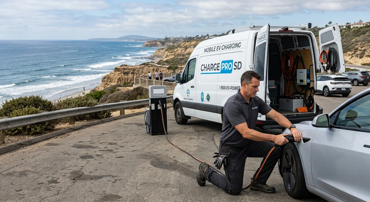
Mobile EV charging on these miles is a Level 2 hookup. It isn’t a Supercharger on wheels. The operator brings a 240-volt source. Teslas take a native NACS plug. Other EVs use a CCS or J1772 adapter. Typical charging time adds about 10 to 20 miles of range. That takes 15 to 30 minutes at the car. It’s not a promise of when someone arrives.
Charge Pro IE doesn’t own the truck. It doesn’t employ the technician or own the gear. Independent local operators do the work. The operator quotes you before starting and bills you directly.
You call and give a location, plus the make and model. Add a rough state of charge. Cross streets help more than a vague neighborhood name. Freeway markers help on I-15. On I-15, say northbound or southbound. Shoulder stops on the Cajon climb are tight. A lot at the Mall of Victor Valley is easier than a dirt road. Main Street in Hesperia is another easy pin. The operator parks, deploys the unit, and connects to your charge port. The goal is enough range to reach the charger you already had in mind. It isn’t a full pack, and it isn’t meant to be.
Empty pack, or a 12-volt that froze overnight
High Desert weather attacks both batteries at once. Summer heat at nearly 3,000 feet cooks a 12-volt sitting in a parked car. Winter nights freeze that same 12-volt overnight. A dead 12-volt makes the whole EV look dead. Doors, screens, and the high-voltage pack can all refuse to wake. The operators we connect you with are licensed and insured. They can jump or replace a 12-volt on site. They handle Tesla and every major EV brand.
If the dash is dark, don’t assume the pack is empty. If the car still talks to you, look at the range number. A zero on that number is a pack problem. A mobile Level 2 charge is for the pack. A 12-volt jump is for the little battery that runs the computers.
Who quotes you, and who doesn’t
Charge Pro IE publishes no rates. The operator who shows up sets the quote. You hear it before any cable goes in. Where you are can change that quote. None of those figures belong on this page. They aren’t ours to invent or guess. See Who sets the price when you need a mobile EV charge for that conversation.
A tow still has a place. If the car won’t take a charge, a hook may be the honest next step. If the 12-volt won’t hold, same story. The operator tells you that before they roll.
When to call
Call when the pack is too low to reach the charger you planned on. The car still has to accept a charge. Call when you’re on I-15 and the number is falling. US-395, SR-18, and SR-138 count the same way. Bear Valley Road, Main Street, and Palmdale Road do too. Call from a warehouse row at the Southern California Logistics Airport. Call from a rural parcel in Phelan or Oak Hills. Call from Wrightwood after a cold night.
Charge Pro IE doesn’t promise a clock. It doesn’t publish hours or arrival estimates. It doesn’t perform the work itself. It matches you with a local operator. That operator quotes before they start, then bills you directly.
When you need that match in the High Desert, call (909) 250-2881.